

Project's EIS documents
If you have difficulty downloading documents, please email cpdinfo@coordinatorgeneral.qld.gov.au
Supplementary EIS
- 01 Supplementary Executive Summary (
 202 KB)
 - 02 Supplementary Executive Summary and Contents ( 210 KB)
- 03 Introduction ( 1.36 MB)
- 03 Introduction Figure 3.1 ( 3.45 MB)
- 03 Introduction Figure 3.2 ( 231 KB)
- 04 Proponent ( 163 KB)
- 05 Description of the existing environment ( 1.36 MB)
- 06 Project Description - Design construction and operational considerations ( 2.80 MB)
- 06 Project Description Figures 6.1 to 6.5 ( 1.20 MB)
- 07 Adverse and beneficial impacts of the project ( 5.54 MB)
- 08 Environmental management plans ( 696 KB)
- 09 and 10 Glossary and References ( 446 KB)
Additional Documents
- Assessment against standard criteria of the EP Act ( 293 KB)
- Does Project cause a statistical increase the nitrogen entering Abbot Bay ( 441 KB)
- Impacts on water quality of the Project ( 2.59 MB)
Appendices
- 01 - Summary of responses received during public consultation ( 1.14 MB)
- 02 - Letter of support from the Bowen Shire Council ( 194 KB)
- 03 - Calculation of daily loads in discharge waters ( 250 KB)
- 04 - Append to Appendix E, draft EIS ( 131 KB)
- 05 - Appendix A ( 128 KB)
- 05 - Appendix B ( 25.8 KB)
- 05 - Coastal geomorphology report ( 126 KB)
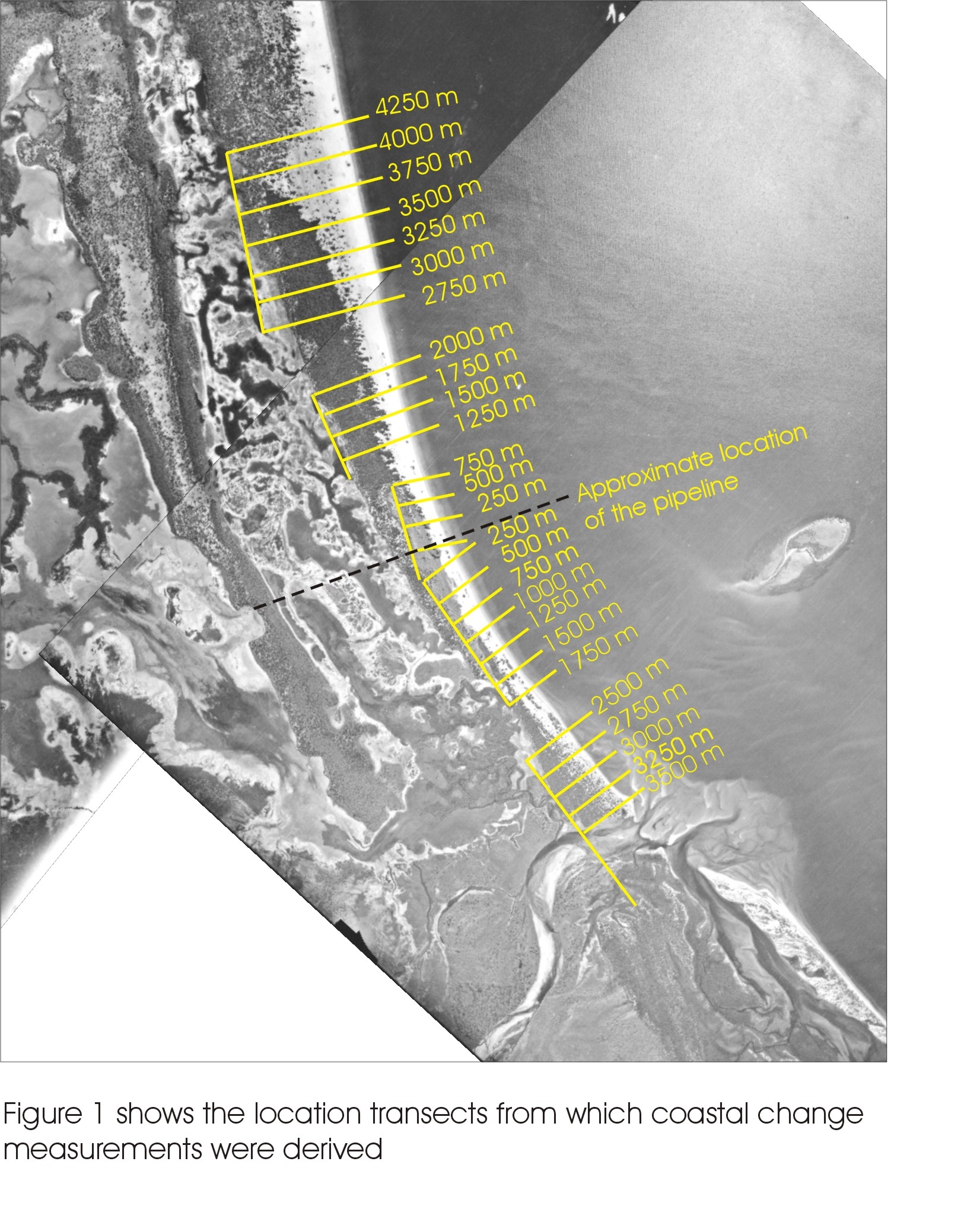
- 05 - Figure 1 ( 1.26 MB)
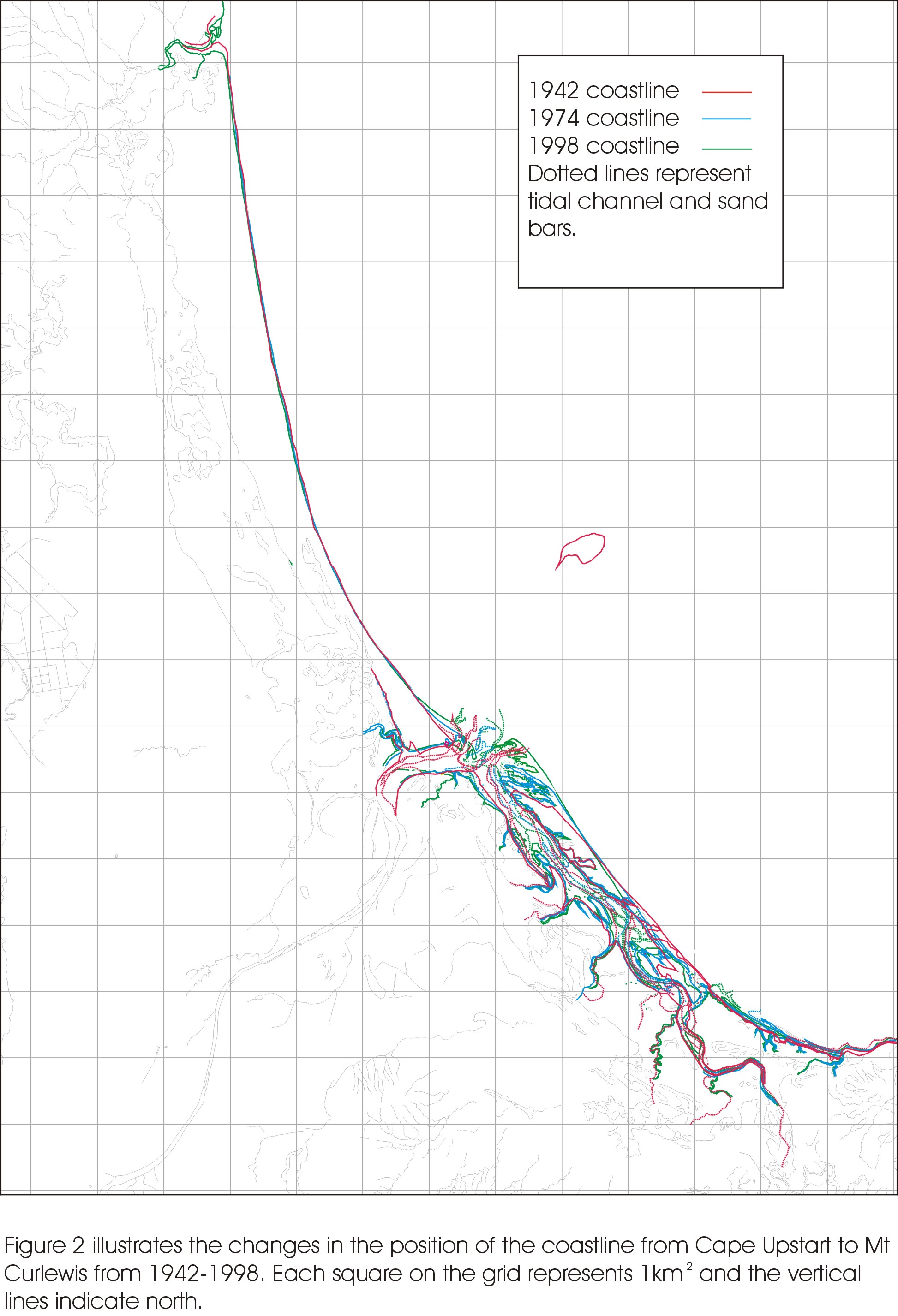
- 05 - Figure 2 ( 655 KB)
- 05 - Figure 3 ( 22.4 KB)
- 05 - Figure 4 ( 760 KB)
- 05 - Figure 5 ( 777 KB)
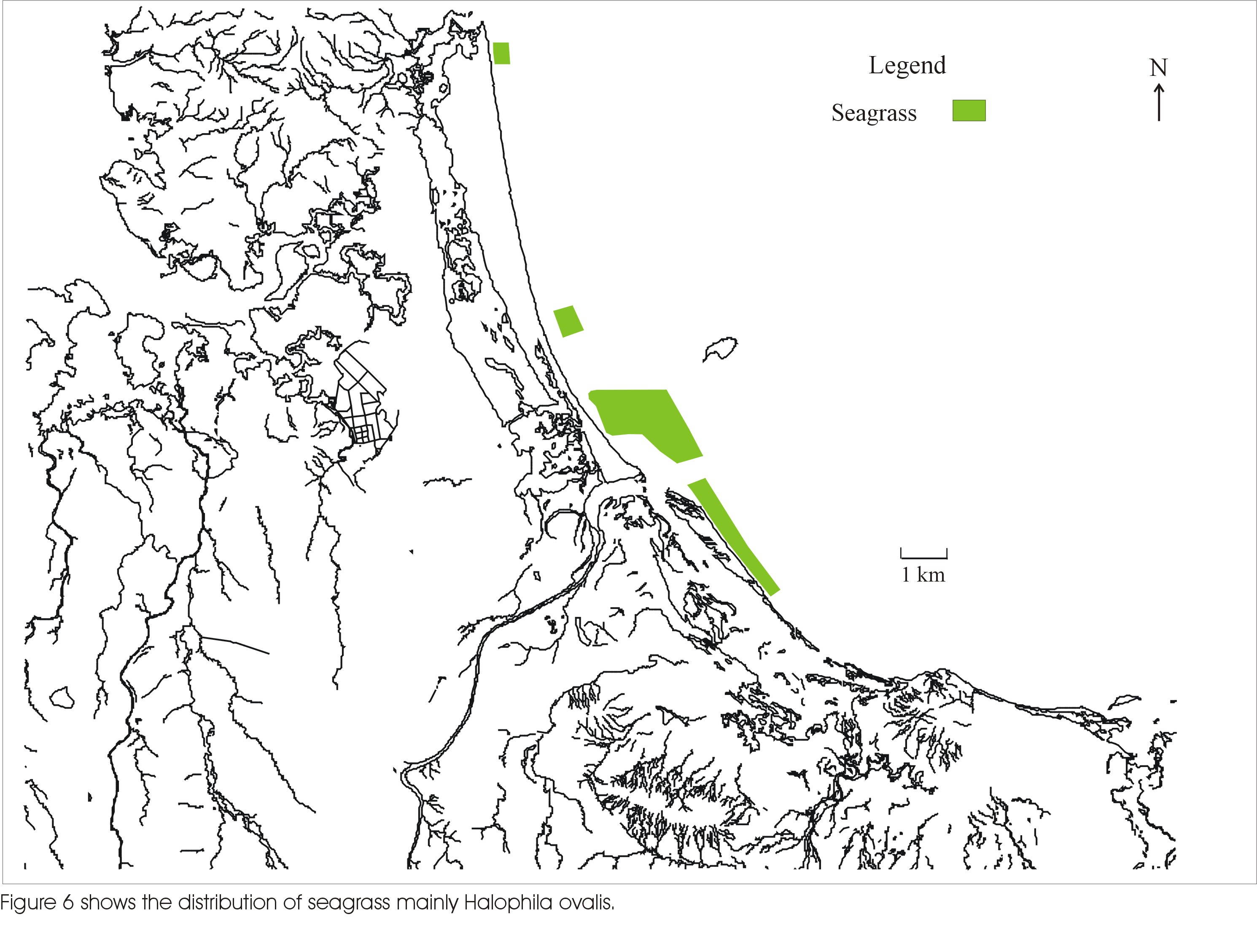
- 05 - Figure 6 ( 820 KB)
- 05 - Figure 7 ( 2.57 MB)
- 05 - Figure 8 ( 650 KB)
- 05 - Figure 9 ( 2.60 MB)
- 05 - Figure 10-17 ( 39 KB)
- 06 - Draft property management plan for wildlife ( 1.98 MB)
- 06 - Draft property management plan for managing wildlife impacts ( 131 KB)
- 07 - Letter regarding the potential impact on seagrass ( 488 KB)
- 07 - Response in respect to impacts on seagrass ( 141 KB)
- 08 - Groundwater model for Alva Beach ( 1.33 MB)
- 08 - Modelling report on groundwater effects of ponds at Alva Beach ( 132 KB)
- 09 - Guthalungra water quality data ( 55 KB)
- 09 - Water quality data collected in Abbot Bay ( 130 KB)
EIS
- Executive Summary ( 263 KB)
- 01 - Introduction ( 540 KB)
- 02 - Background ( 127 KB)
- 03 - Need for the proposal ( 70.8 KB)
- 04 - Description for the proposal ( 779 KB)
- 05 - Alternatives ( 85.1 KB)
- 06 - Existing Environment ( 1.71 MB)
- 07 - Environmental impacts ( 1.49 MB)
- 08 - Health and Safety ( 35.8 KB)
- 09 – Safeguards mitigation management and monitoring ( 493 KB)
- 10 – Studies consultation and public participation ( 69.4 KB)
- 11 - Environmental records ( 16.4 KB)
- 12 - Conclusions and recommendation ( 40.4 KB)
- 13 - References and information ( 57.7 KB)
- 14 - Recommended appendices ( 74.8 KB)
Appendices
- Abbot Bay Marine Habitat Survey-Scientific Marine ( 700 KB)
- Acid Sulphate Additional Borehole Locations-Pipelines ( 522 KB)
- Acid Sulphate Borehole Locations ( 0.99 MB)
- Administration, Workshop, Processing & Fuel Storage ( 84.7 KB)
- Cross referencing of Terms of Reference ( 314 KB)
- Area 1 Pond Exchange Calculations ( 11.4 KB)
- Area 1 Pond Release Calculations ( 7.19 KB)
- Area 2 Pond Exchange Calculations ( 13.2 KB)
- Area 2 Pond Release Calculations ( 17.4 KB)
- Area 3 Pond Exchange Calculations ( 9.67 KB)
- Area 3 Pond Release Calculations ( 12.5 KB)
- Assessment of Cyclone - Induced Erosion of the Foreshore ( 2.43 MB)
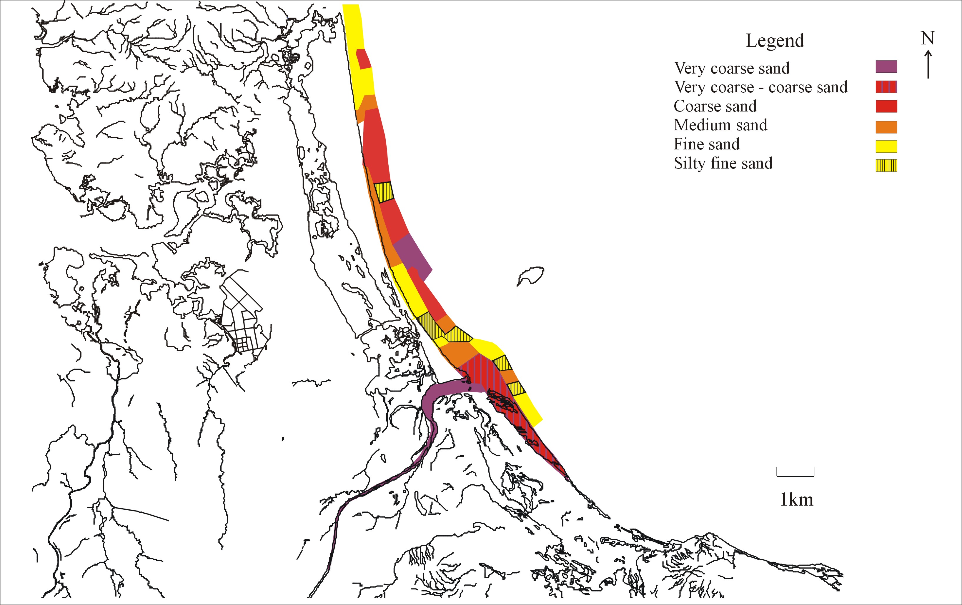
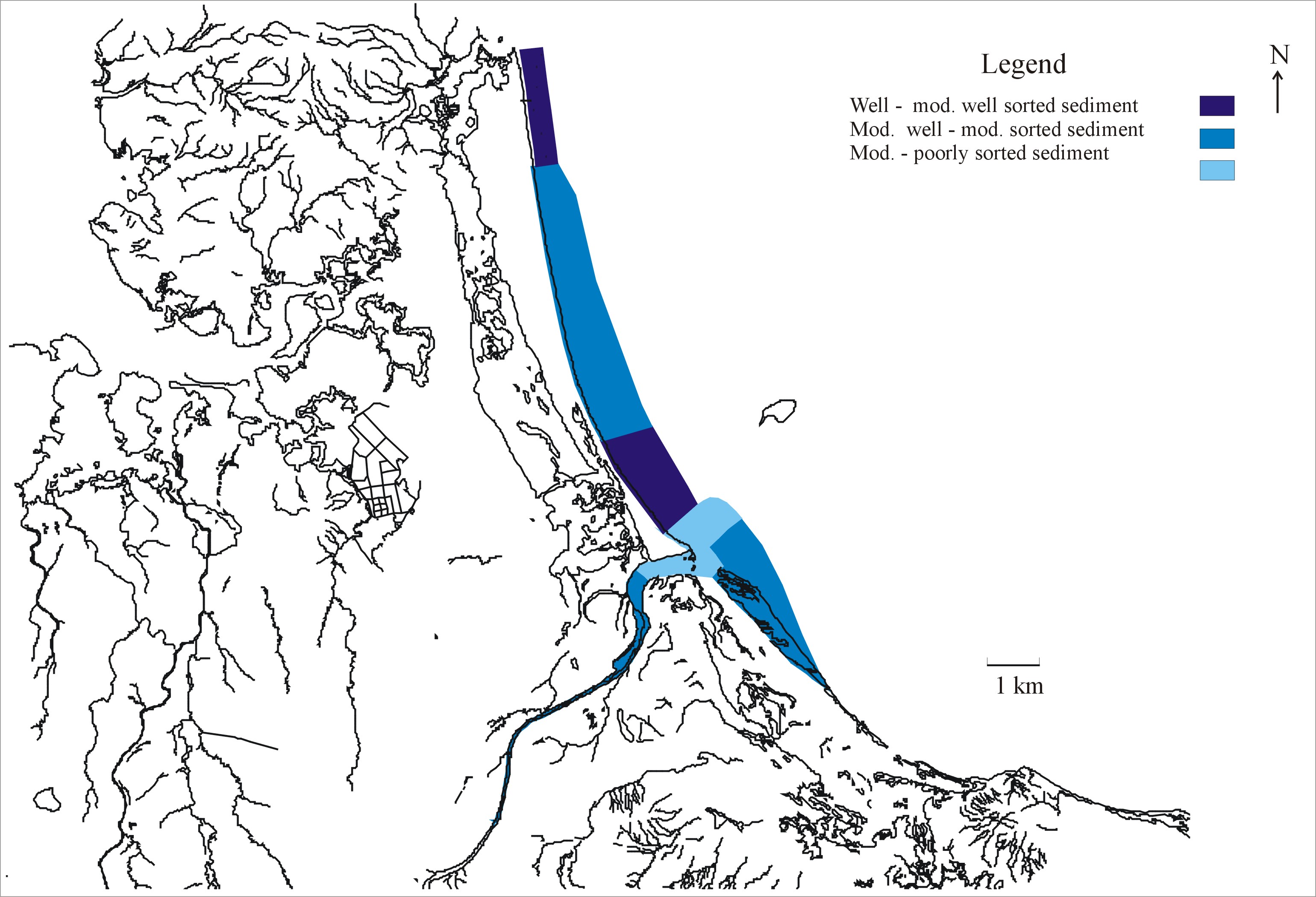
- Coastal Geomorphology of the Guthalungra Region ( 126 KB)
- Consultation Plan ( 80.1 KB)
- Development Area ( 578 KB)
- Diffuser & Ocean Pipeline Anchor Block Design ( 84.5 KB)
- Discharge Pipeline Long Section ( 118 KB)
- Disposal Pump Station Site ( 129 KB)
- Disposal Pump Station ( 13.4 KB)
- Elliot River Monitoring Report ( 12.5 KB)
- Figure 6.6 Elliot River Overland Flow Patterns ( 2.48 MB)
- Flood Assessment Report ( 243 KB)
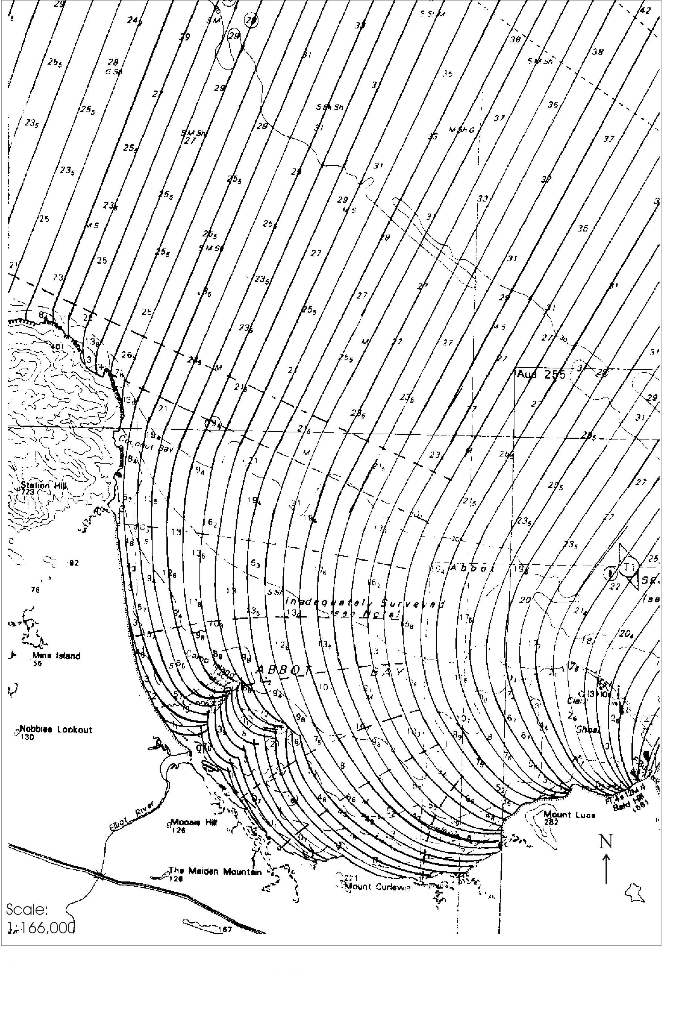
- Flood Study Figure 1 ( 1.31 MB)
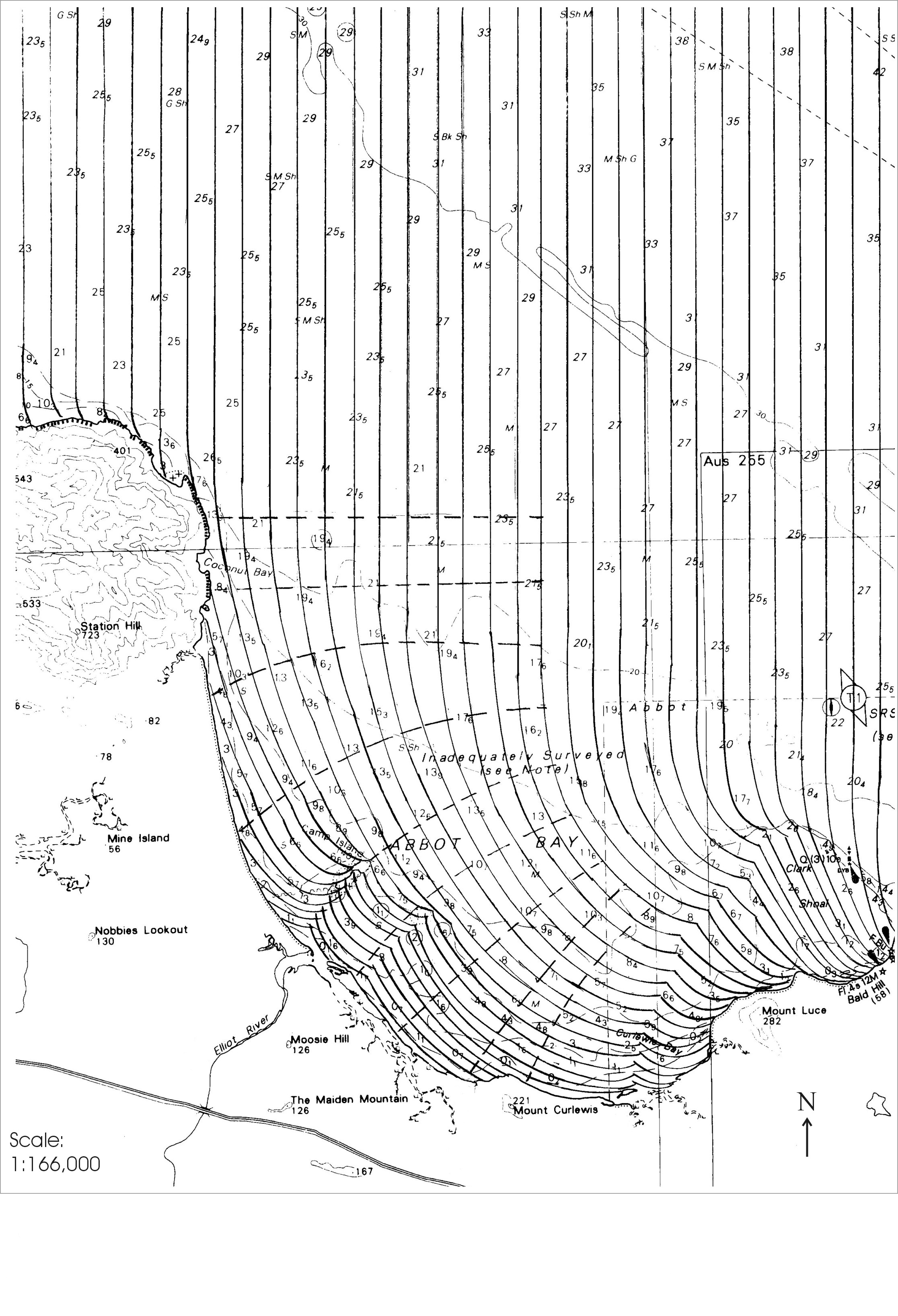
- Flood Study Figure 2 ( 228 KB)
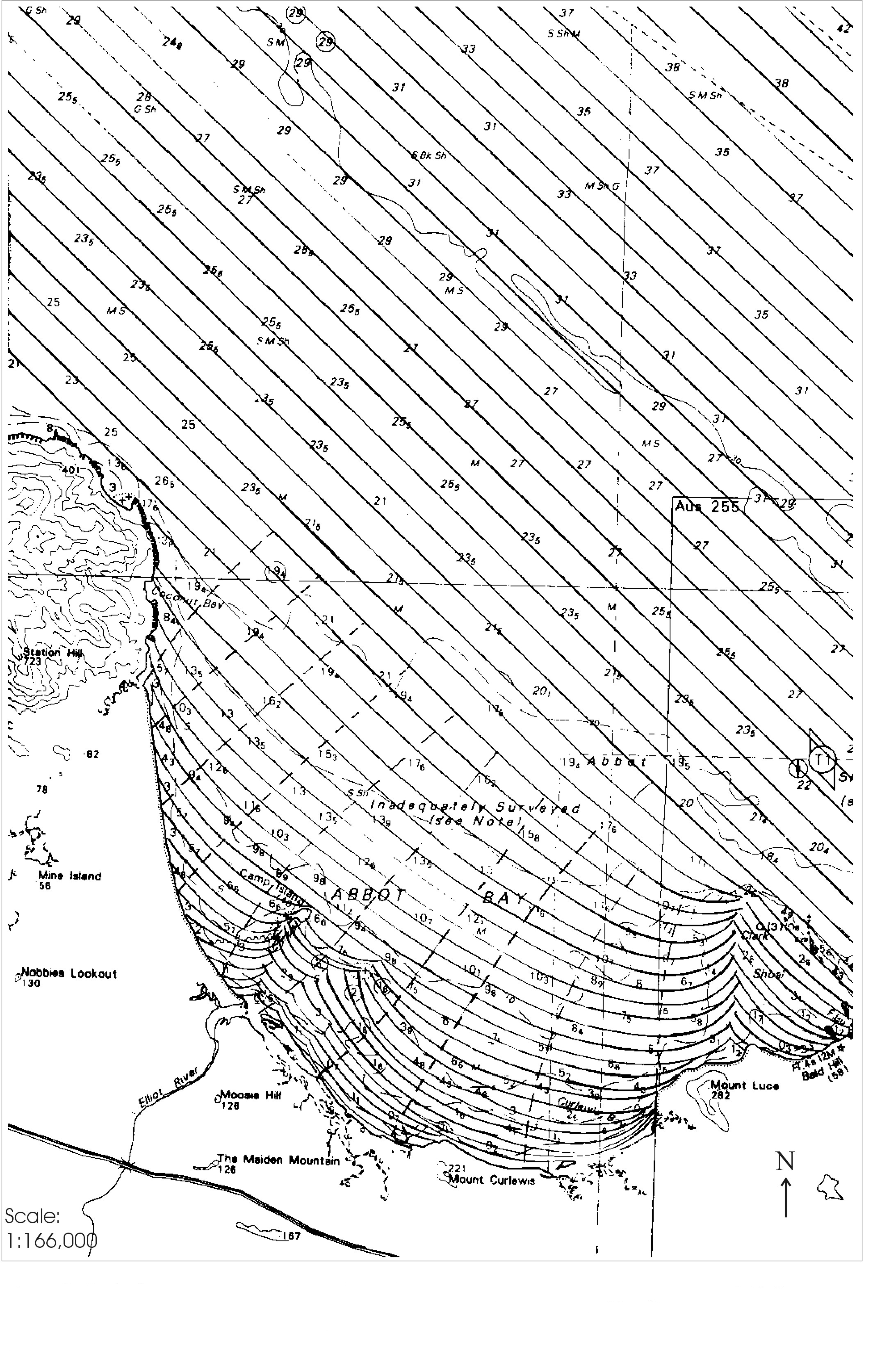
- Flood Study Figure 3 ( 355 KB)
- Flood Study Figure 4 ( 787 KB)
- Flood Study Figure 6 ( 783 KB)
- Flood Study Figure 7 ( 113 KB)
- Flora and Fauna Report ( 936 KB)
- Geotech Study Borehole Locations ( 0.99 MB)
- Ground Water Bore Locations ( 402 KB)
- Groundwater Report ( 1.69 MB)
- Guthalungra Prawn Farm Geohydrology Study ( 276 KB)
- Guthalungra Prawn Farm Noise Assessment ( 172 KB)
- Intake Pipeline Long Section ( 119 KB)
- Intake Pipeline Long & Cross sections ( 138KB)
- Intake Pump Station Arrangement ( 142 KB)
- Intake Pump Station Site General Arrangement ( 185 KB)
- Media Releases and Correspondence form Stakeholder Groups ( 1.14 MB)
- Modelling the movement and concentration of discharge ( 7.43 MB)
- Overall Layout Plan & Cross Section Locations ( 119 KB)
- Overall Layout Plan ( 765 KB)
- Overall Layout Typical Cross Section Locations ( 202 KB)
- Pipeline Pump Station and Ocean Pipeline Locations ( 4.94 MB)
- Pre-construction ( 67 KB)
- Proposed Farm Areas ( 232 KB)
- Proposed Layout Staging Plan ( 186 KB)
- Proposed Works-Year 1 Construction ( 116 KB)
- Proposed Works-Year 2 Construction ( 141 KB)
- Proposed Works-Year 3 Construction ( 170 KB)
- Proposed Works-Year 4 Construction ( 238 KB)
- Raw Water and Wastewater Treatment Systems Specification ( 82.6 KB)
- Report on Acid Sulphate Soils Assessment Proposed Prawn Farm ( 83 KB)
- Report on Geotechnical Investigation Proposed Prawn Farm ( 77 KB)
- Seawater Intake Screen ( 102 KB)
- Selected Sections & Details 1 ( 147 KB)
- Selected Sections & Details 2 ( 122 KB)
- Site Topography Plan ( 379 KB)
- Stage 1 ( 62.4 KB)
- Stage 2 ( 56 KB)
- Stage 3 ( 54.1 KB)
- Stage 4 ( 56 KB)
- Test Location Plan ( 423 KB)
- Terms of References and Membership of TAG ( 83.1 KB)
- Total Discharge Data ( 106 KB)
- Typical Cross Sections ( 85 KB)
- Water Quality Management Preliminary Concept ( 309 KB)
Last updated: 16 Mar 2023